Getting data from a STAC catalogue
The purpose of this vignette is to demonstrate how we can use the STAC package to get data from STAC services.
This functionality is supported through an extension, which is only active when the STAC package is loaded.
using SpeciesDistributionToolkit
using CairoMakie
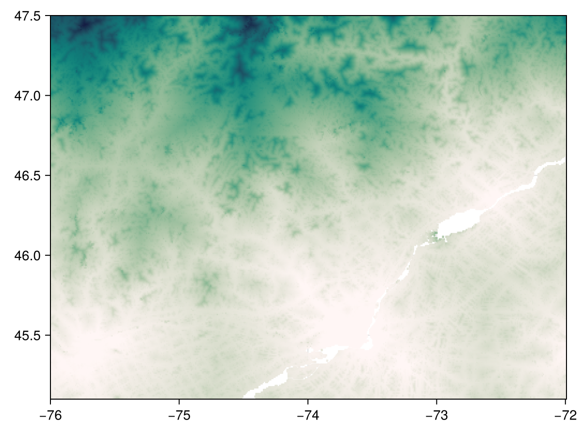
using STAC The support is currently very bare-bones, and can return a layer when given an asset. To demonstrate, we will get the time to the nearest city (in minutes) from the BON in a Box STAC catalogue:
biab = STAC.Catalog("https://stac.geobon.org/")
access = biab["accessibility_to_cities"].items["accessibility"].assets["data"]
L = SDMLayer(access; left=-76.0, right=-72.0, bottom=45.1, top=47.5)
🗺️ A 288 × 481 layer with 136513 Int32 cells
Projection: +proj=longlat +datum=WGS84 +no_defsNote that the first argument is a STAC asset, but the usual keywords arguments to crop a layer apply here. The ability to crop is important, because the STAC layers can be very, very large. Information about the resolution and extent of the assets is provided by the STAC catalogue / API.
Most public STAC instances are available through the stacindex.org website.
We can visualize the resulting layer:
Code for the figure
heatmap(L; colormap=:tempo)